 A robust north-easter is forecast, but since we are doing a loop north then back south on the island of Texel, we care not — well not much. Three non-riders care not at all as they accompany riders on the ferry and then visit Den Burg by bus.
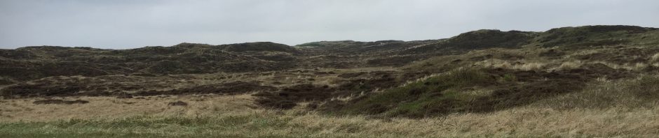
Texel is the first and largest of the chain of islands that spreads to the north and east of the Netherlands and on to the north coast of Germany, is pear-shaped and, of course, largely flat. Only the line of sand dunes in the west relieves the flat countryside, and these are sandy scree with grasses and tussock, not unlike many other coastal sandy dune environments. Indeed a similar effect is found in mountainous areas like the Bogong high plain and Snowies, where the cold weather stunts growth.
We take a large and popular vehicular ferry across from Den Helder to the south end of the island, then ride NW towards these sand dunes, We share the excursion with many travellers, often families with two or three children enjoying the school holidays.
 Some of these families bring their cycles with extra seats for small children, tandems with a smaller seat on front, or seats for small fry at the back. Regardless of the design of their mounts, they are often seen passing us at about twice our speed, no helmets, sometimes wearing just T-shirts (it’s not raining is it?), flaxen hair flying in the breeze.
Proceeding north inside the line of hills, we enter beautiful pine forest for a while. Here, the cycle paths are more narrow and the surface sometimes rough due to the tree roots and frequent repairs.
A potential coffee stop at an Eco-nature centre, attracting many families with young children for the displays on seals, whales and other natural features, is thwarted since the cafe is inside the centre, protected by a high entrance cost. We don’t have time to do it justice so ride on another 500 metres to the beach, where Paal71, whoever he is, provides excellent hot drinks and Internet access as we look out across a nice natural deserted beach to grey sea and grey sky to the west. Funny how that internet issue comes up every day!

Tav’s jacket safely stowed
Passing through the pretty township of De Hoorn, we dismount to walk through the pedestrian mall. This provides a welcome break where people buy (and play with) bounding balls and such small memorabilia. Except Tav, who buys large memorabilia in the shape of a harlequin-plus multi-coloured knitted coat. Some of the ladies lend their artistic and fashion advice to ensure his choice is almost within the bounds of normal and reasonable taste.
 The continuing northbound slog against headwinds is rewarded first by a huge field of purple blossom — was it hyacinth, gardening experts? — and finally at the 23 km point, to the lookout of the Schlufter.
This is a gap in the row of dunes nearest the sea, where a shallow river flat enters and drains the low wetlands between sea and hinterland. It is connected to the inland waterway only at high tide.
Returning southwards and downwind, progress is so rapid that Janette is clocked at a healthy 30 kph by Tav’s shiny new GPS. Meanwhile the pedestrian party have been enjoying the village life of Texel at Ouderschild. They catch the bus back to the ferry and are first home by a country mile.
Map and Stats for the riders HERE>

Pointing out the new GPS at De Hoorn

Nico points out tree lines sculptured in the prevailing winds.


